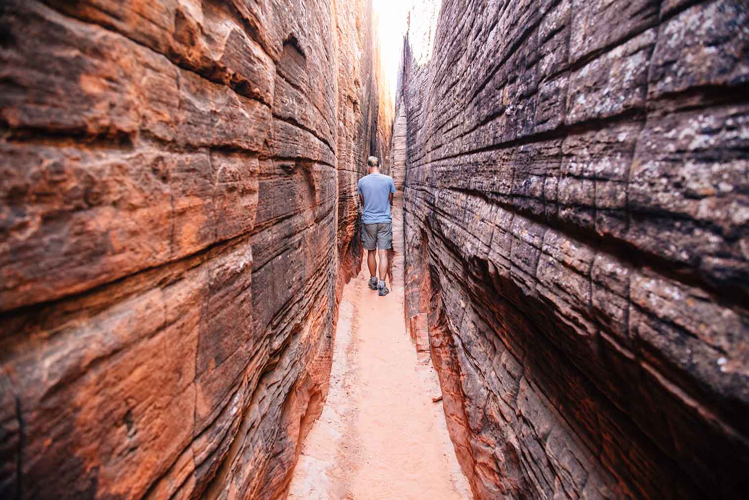
Slot canyon with petroglyphs at Snow Canyon State Park
Snow Canyon State Park is a Utah state park featuring a canyon carved from the red and white Navajo sandstone in the Red Mountains. The park is located near St. George in Washington County, Utah. Other geological features of the state park include extinct cinder cones, lava tubes, lava flows, and sand dunes.
Overview[]
Explore the trails and dunes of beautiful Snow Canyon on foot, bike, and horseback. Camp in the peaceful campground surrounded by ancient lava flows and red Navajo sandstone. Discover the secrets of the desert landscape through seasonal nature programs.
Ancient lava flows spill over the eastern edges of Snow Canyon from above, where the road climbs out of the canyon. The park boundaries extend northeastward, across State Route 18, to encompass two cinder cones along the western edge of Diamond Valley.
This park is administered by Utah State Parks which is a division of Utah Department of Natural Resources. Discover the beauty and history found in the many State parks of Utah. A wide variety of great activities are available including over 2000 campsites.
See also Scouting in Utah.
Local History[]
Snow Canyon is named after early Mormon settlers Lorenzo and Erastus Snow. It was designated as a Utah State Park in 1958.
Two canyons, West Canyon and Snow Canyon, begin side-by-side at the north gouging deeply into the sandstone of the Red Mountains, each canyon then running southward, slowly converging then finally meeting in the middle of the park. From there Snow Canyon continues south-by-southeastward as a single, larger canyon. Near the park's southern entrance, the canyon ends, its mouth opening out onto the Santa Clara bench near Ivins, Utah.
Wildlife and Nature[]
Snow Canyon sits at the junction of the Mojave Desert, Great Basin, and Colorado Plateau. The climate is typical for a desert. Higher elevations tend to be dry and cooler. Lower elevations are also dry, but much warmer.
Summers are hot with low temperatures in the low 80 degrees Fahrenheit to high temperatures over 105 °F (41 °C). Winters can range from lows in the mid 20 degrees Fahrenheit to highs in the 60 degrees Fahrenheit ranges.
The vegetation of the area mainly consists of desert plants, such as creosote bush, scrub oak, yucca, cacti, and sagebrush. Various types of desert shrubs are found in the park against the rock formations
Wildlife in Snow Canyon includes the Gila monster, peregrine falcon, and desert tortoise. Small fences to keep the ground-dwelling creatures from accidentally wandering onto roads can be seen across Snow Canyon and the St. George area. Other notable wildlife include the giant desert hairy scorpion, coyote, Mojave sidewinder, red-spotted toad, Utah banded gecko, and the side-blotched lizard, among many others.
Camping[]
Trailheads[]
- Johnson Canyon Trail (to a large arch) below the toll gate at the south entrance to the park may be accessed without payment of fees, but is closed to hikers most of the year, to protect nesting bird populations. The Johnson Canyon trail is usually only open from about November 15 to March.
- Whiptail Trail - (6.0 miles). Easy. Level with some slopes. Accessible to physically challenged. Tucked along the canyon bottom, this sinuous paved trail is suitable for hiking, jogging, biking and rollerblading.
- Jenny's Canyon - (Closed March 31 to June 1) -One-half mile. Easy, level with few slopes and steps. Trail leads to a narrow, sculpted canyon then splits with rock stairsteps to offer a scenic overlook.
- Sand Dunes - One-half mile. Easy. Deep sand with some slopes. Trail leads to a large expanse of red sand that is an excellent play area for children of all ages.
- West Canyon Road - (7.0 miles). Easy. Gravel and sand surface. Fairly level. Trail follows a maintenance road winding past washes and towering cliffs to the mouth of present-day Snow Canyon.
- Pioneer Names - One-half mile. Easy. Fairly level with some steps and slopes. This crescent-shaped trail passes pioneer names written in axle grease, dating back to 1883.
- Hidden Pinyon - (1.5 miels). Moderate. Rocky slopes. Drop-offs. This self-guided nature trail introduces geological features and native plants of the park.
- Three Ponds - (3.5 miles). Moderate. Some rocky slopes. Deep sand. Trail winds through sandy washes to mouth of a Template:Convert canyon. Potholes eroded in sandstone catch seasonal rain, giving the trail its name.
- Petrified Dunes Trail - Template:Convert. Moderate. Some steep slopes, uneven surfaces. This trail crosses massive sandstone outcrops where you may explore sand dunes frozen in time.
- Butterfly Trail - (2.2 miles). Moderate. Some steep slopes, steps and uneven surfaces. Winding along the west side of Petrified Dunes, this trail leads to West Canyon Overlook and lava tubes.
- White Rocks Trail/Lava Flow Overlook - (3.9 miles). Moderate. Some rocky slopes, uneven surfaces. Passing through lava flows, juniper stands and breathtaking views of West Canyon, trail leads to a natural amphitheater set in white sandstone. Or reach the amphitheater on a trail located one-half mile north of State Route 18 junction.
Park Recreation[]
Park Headquarters[]
External Links[]
References[]
- National Parks of America - an informative and gorgeous tour of all 59 parks with our lavishly finished hardcover gift guide packed with detailed itineraries and practical tips on what to do and see in each park (2016 - Parks 100th Anniversay Edition)
- State Parks of Utah - the state parks are so rich in history, varied in beauty, and abundant in recreational opportunity.
- Utah's National Parks - 50 popular short hikes where each holds some of the most awe-inspiring geology on the planet. Each park offers visitors the dramatic scenery that invites exploration and discovery.